
PROJECT 007
A history, a fragment, a territory
Rebecca Tanda
11.08.2019 - 12.15.2019
As a result of an impulse for shelter, humans have modified their environs by creating tools and building structures. The records of these interventions persist, sometimes irrevocably. Sometimes they are maps that have been created and modified, and sometimes these records are physical leftovers – in stone, wood, concrete, metal, or glass. Sometimes they take form through the stories, divisions and organizations in our society.
At what point is a history visible?
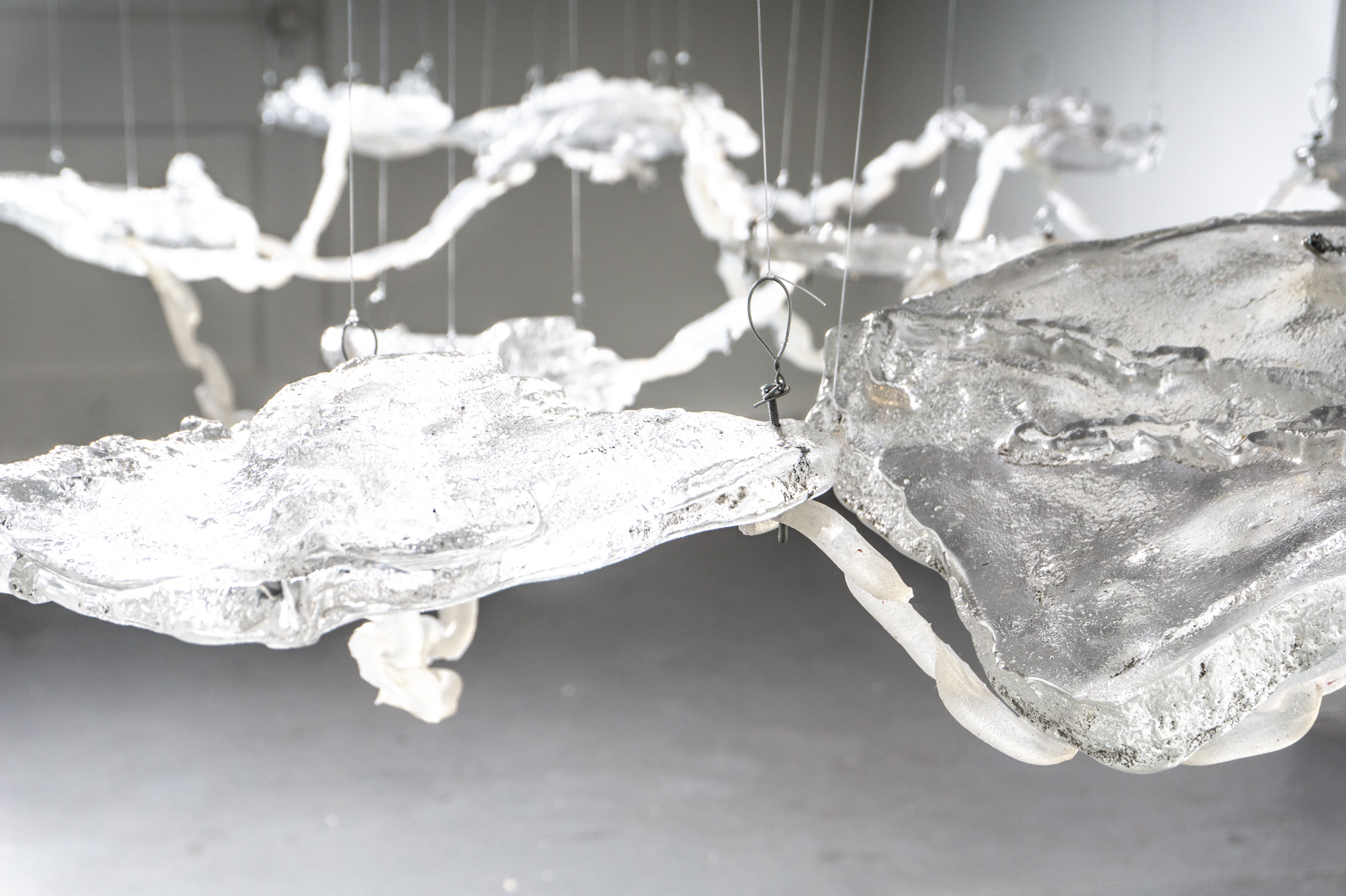
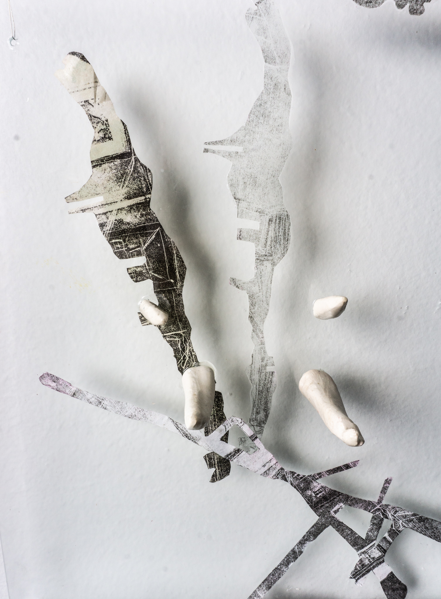
This November, EXTRA showcases the work of Rebecca Tanda, featuring mixed media and sculptural work paired with a site specific installation in manufactured materials such as glass and plastics. Topics such as development, neighborhood change and technology are investigated by referencing the history of the exhibition space. Through layers of opacity and transparency rendered physical, Tanda invites us to consider how these concerns might influence our lives now.
Borders, at all scales—from gerrymandered constituencies to territorial disputes between countries—are constantly being redrawn and re-rendered. Despite existing only digitally inside databases, or as images on maps and in atlases, they have very concrete, physical consequences, as they control the flows of materials, people and ideas.
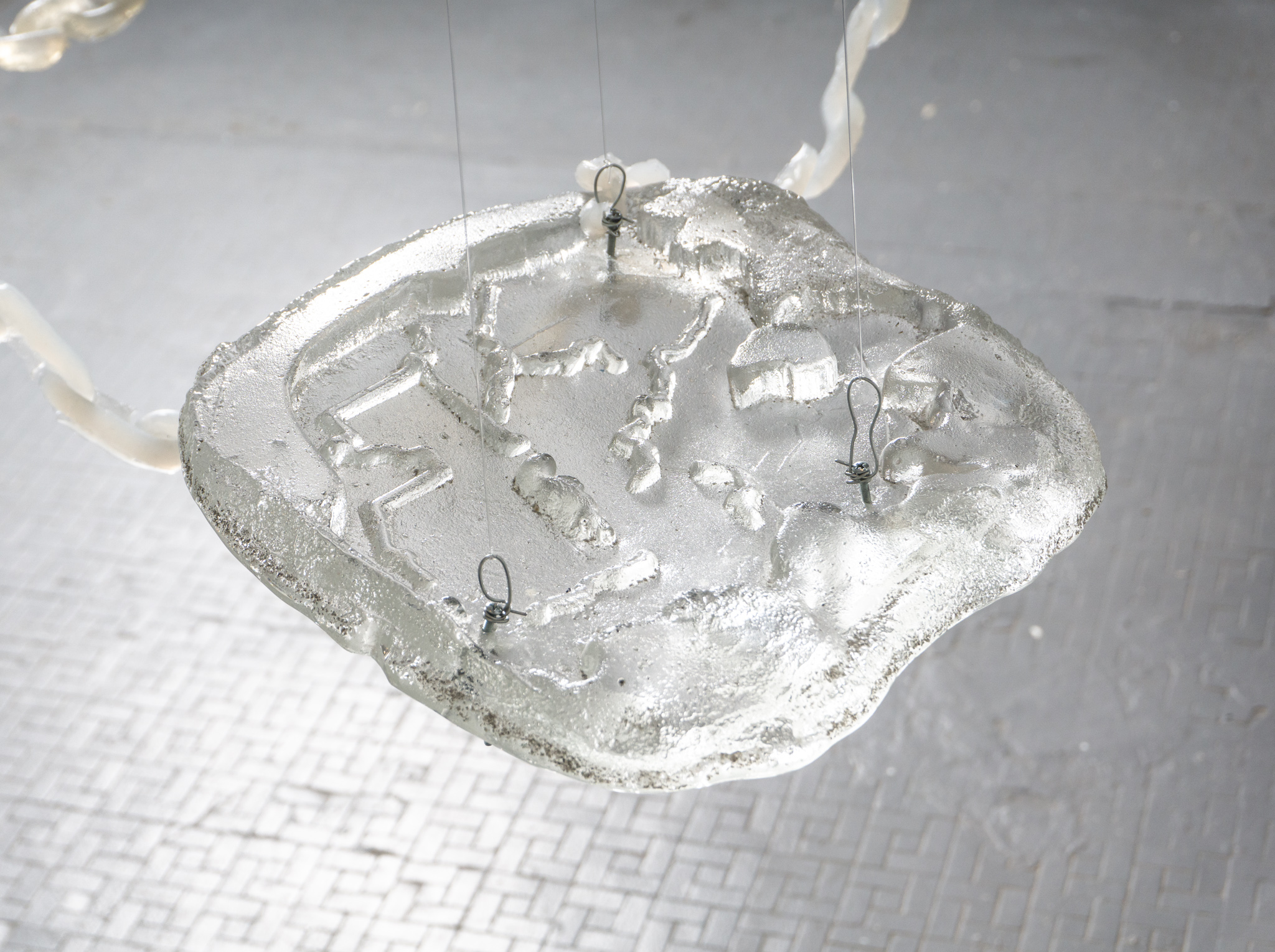
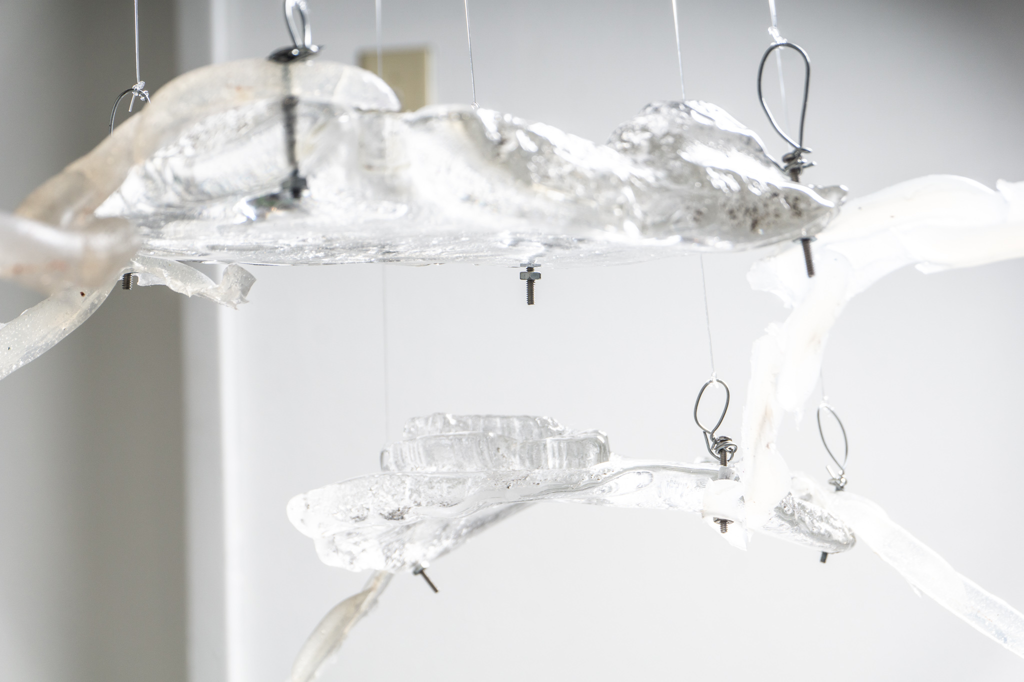
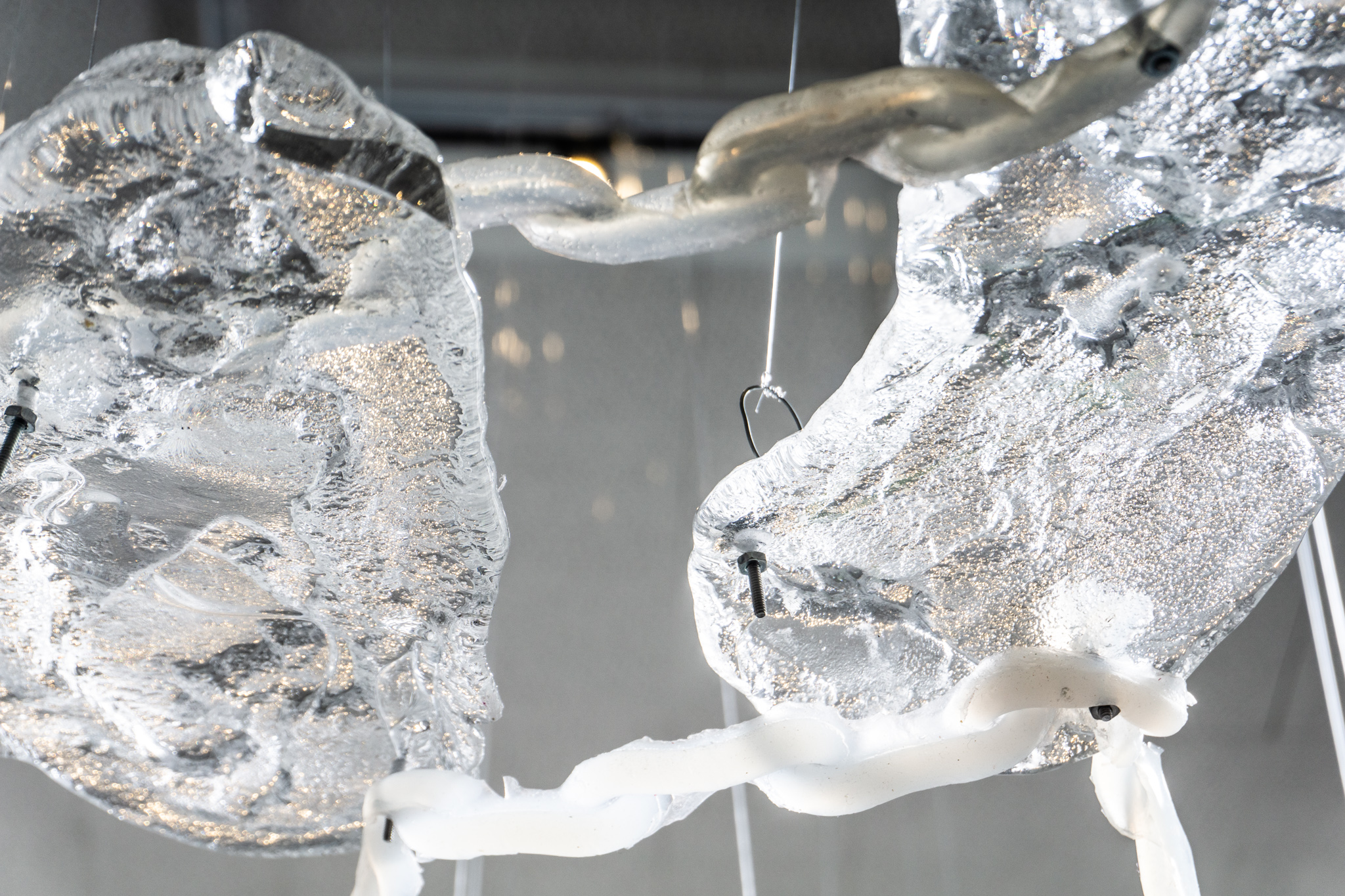
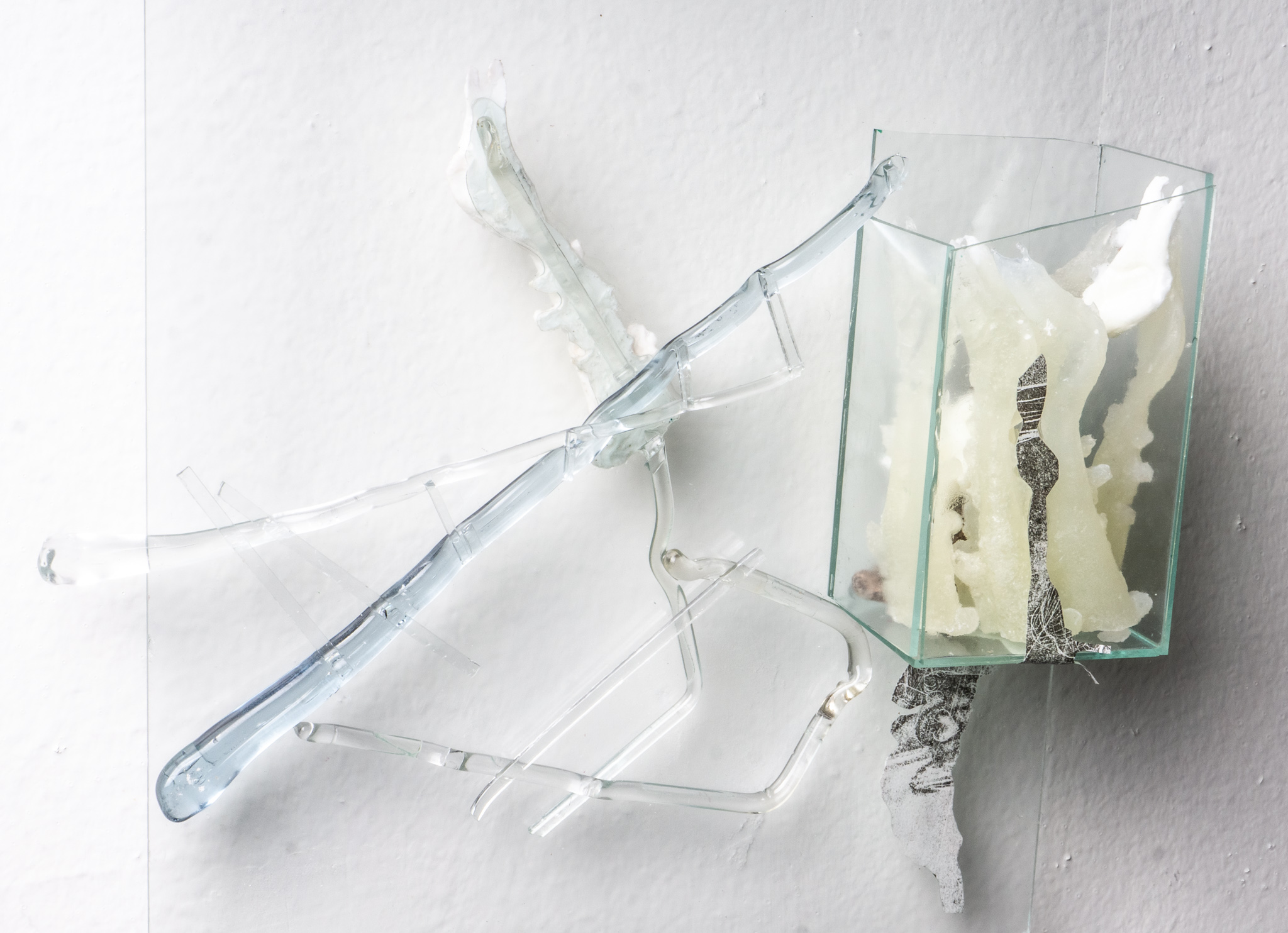
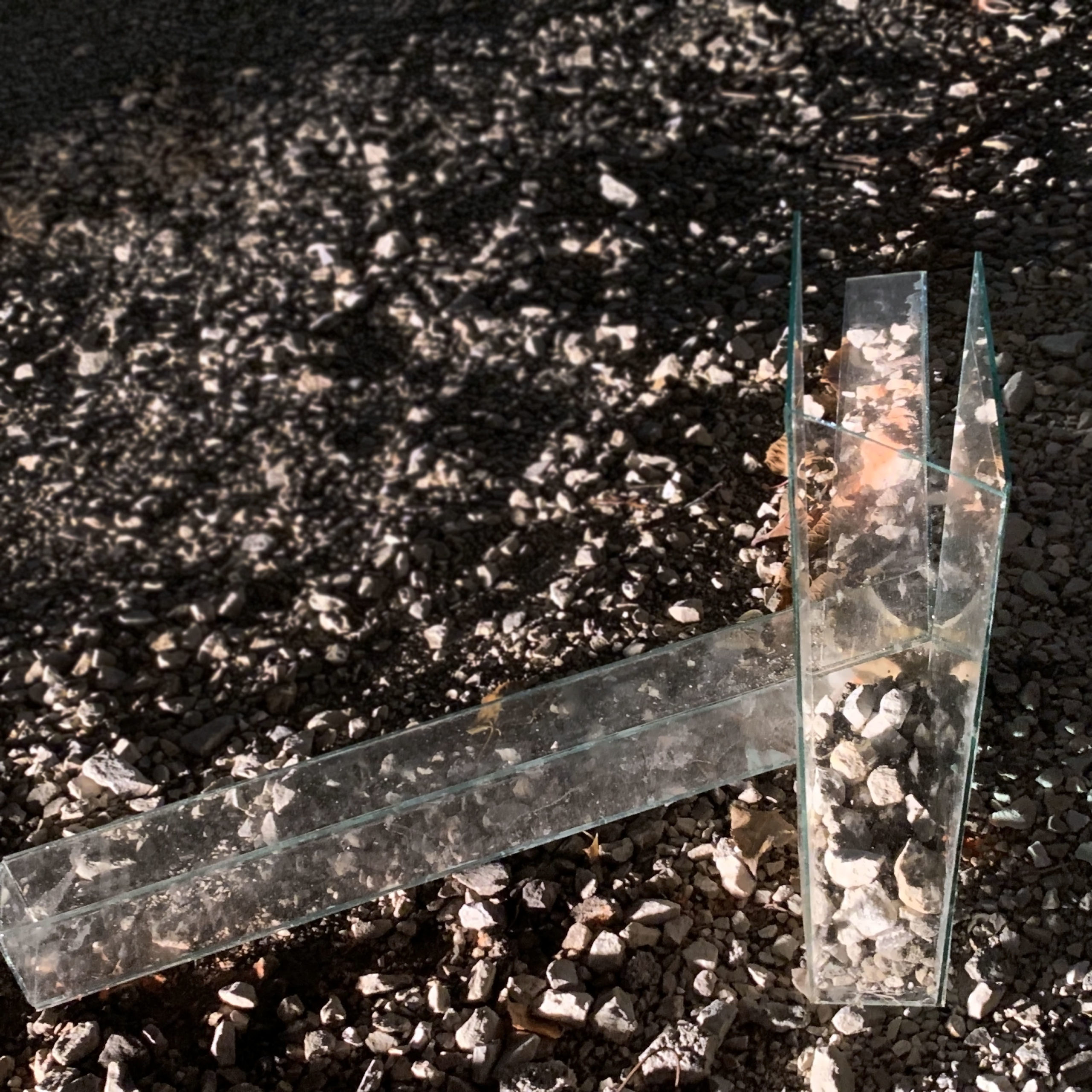
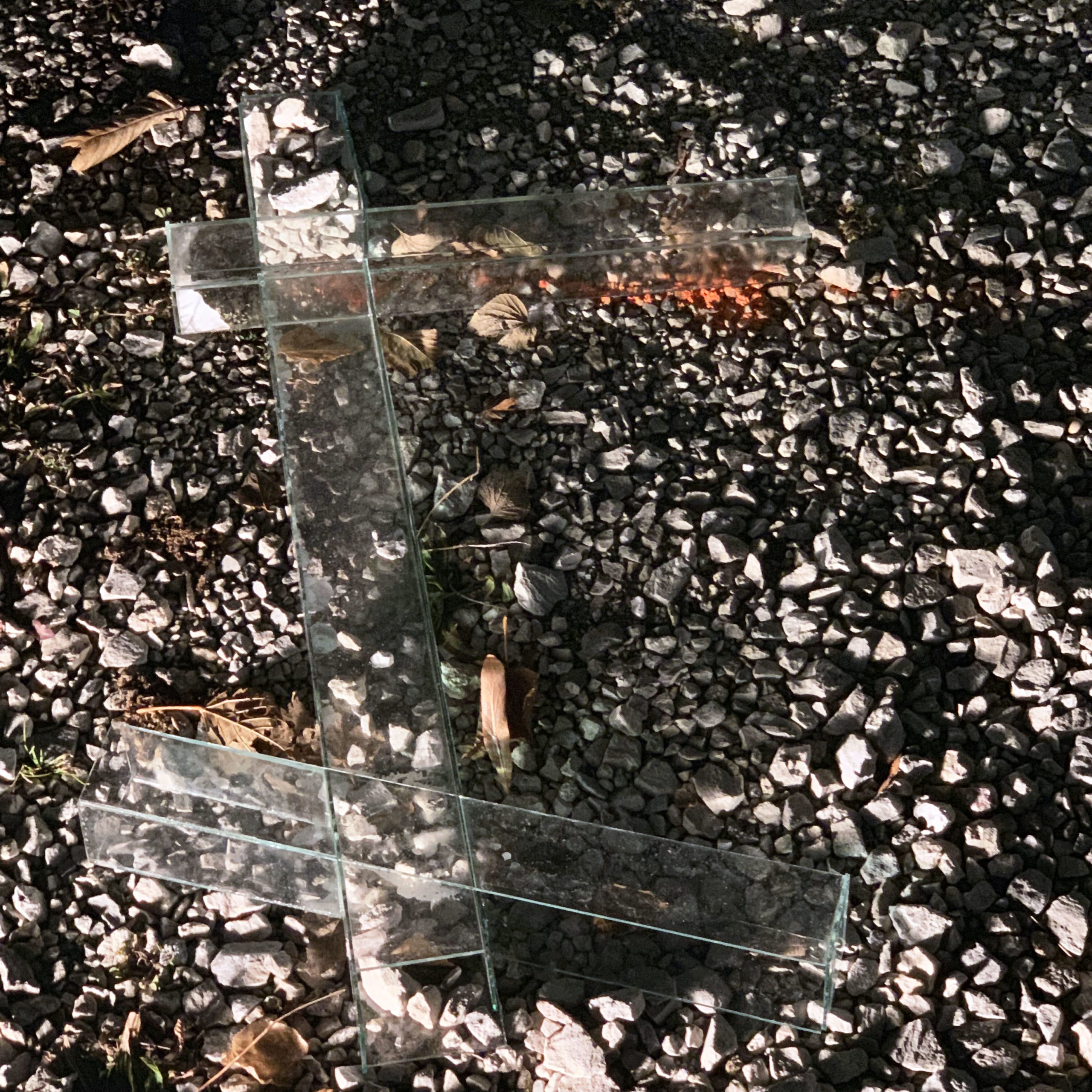
In this installation, I consider the physical geometries of the political borders that constitute the countries on our planet. Through a digital and material translation process, they are obscured and abstracted; becoming first wooden molds, then sand imprints and, finally, glass geode-like tiles. Arranged in a quasi-grid-like formation, they toy and tease with the grid as a structure that arranges and organizes information and phenomena. Likewise, the chain as a structure and a motif is questioned: as a form that not only restrains, but also gives form and creates new links and entanglements.
The process of casting and creating molds, the ebb and flow of material, becomes in many ways analogous with how landforms form over time. The ritual of mold making and casting takes on a very generative position in her practice. This is further explored and articulates through the dimensional wall pieces that accompany the hanging installation.
Ultimately, I am not only exploring the absurdity of borders, but also the malleability of representational and physical space: their interconnectedness and interdependence. With this gesture of suspending a grid in an artist-run space, atop the ground plane of a city built with a most rigid of grid plans, one is left to consider strategies of renegotiating and subverting the spatial context that we inhabit.


For our first exterior art installation, please enjoy work by sculptor Rebecca Tanda installed throughout the Sidelot. An MFA candidate at the School of the Art Institute of Chicago, Tanda has exhibited internationally and creates work that investigates the boundaries created by societies, using cartography as a point of departure for investigating social, geopolitical, and societal boundaries.
In conjunction with the exhibition on view at EXTRA Projects, titled A history, a fragment, a territory, Tanda has responded directly to the unique circumstance provided by the lot installing a series of site-specific ‘interventions’. These pieces correspond to overlapping intersections of the perimeters of the various buildings that have existed on this particular plot of land over the last hundred plus years. In doing so, Tanda looks at this history and considers the impulse of street corners as intersection points for commercial and social activity, and questions the roles that developers, politicians, and private citizens have played to create that shared landscape.
ON EXACTITUDE IN SCIENCE
…In that Empire, the Art of Cartography attained such Perfection that the map of a single Province occupied the entirety of a City, and the map of the Empire, the entirety of a Province. In time, those Unconscionable Maps no longer satisfied, and the Cartographers Guilds struck a Map of the Empire whose size was that of the Empire, and which coincided point for point with it. The following Generations, who were not so fond of the Study of Cartography as their Forebears had been, saw that that vast Map was Useless, and not without some Pitilessness was it, that they delivered it up to the Inclemencies of Sun and Winters. In the Deserts of the West, still today, there are Tattered Ruins of that Map, inhabited by Animals and Beggars; in all the Land there is no other Relic of the Disciplines of Geography. —Suarez Miranda, Viajes devarones prudentes, Libro IV,Cap. XLV, Lerida, 1658
Jorge Luis Borges, Collected Fictions, translated by Andrew Hurley.
In Borges’ short story ‘On Exactitudes in Science’1, a fictional empire produces a map the size of the empire itself. The following generation destroys the map, leaving it to fray in the winds. The totality of maps is now not the same size, but in fact far, far larger than the empire itself, as the data footprint that geographic imagery occupies digitally far surpasses the surface of the earth. Since the first aerial image of the earth from space was publicized in 1966 (which was withheld for five years after it was first captured, as the US government believed showing a spherical unified earth would result in a crippling of national and political identity)2, geo-spatial technologies and services have proliferated at an unprecedented rate, with Google Maps has become the most viewed graphic interface in history, averaging around one billion viewers per diem. But what information goes unrepresented? Using satellite imagery and archival Fire Insurance Maps, I set out to redraw the previous floor plans of the vacant lot.
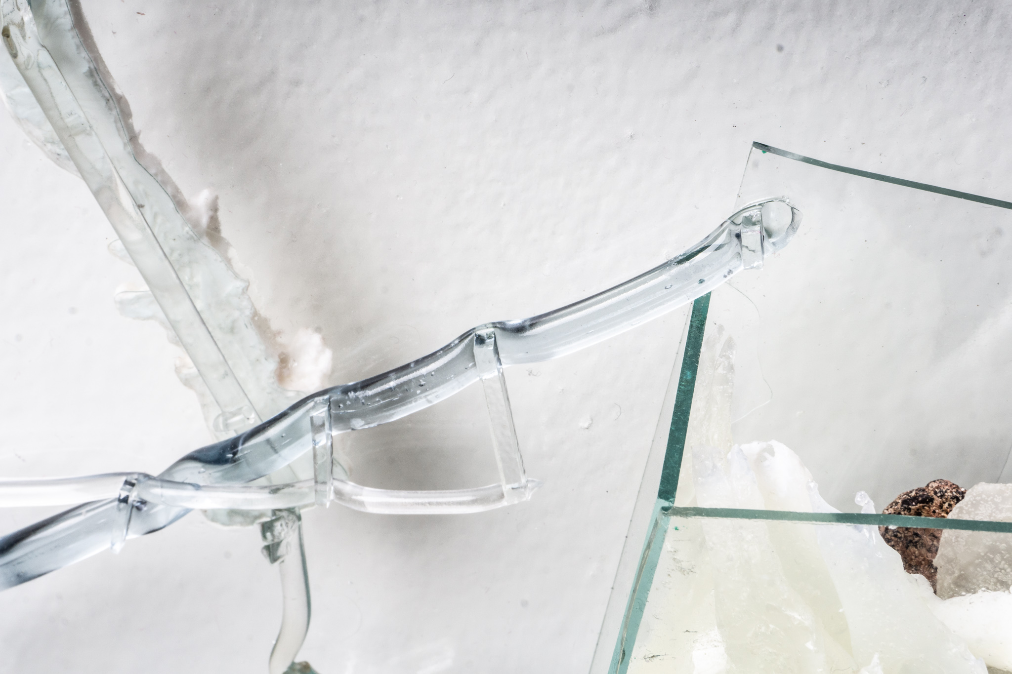
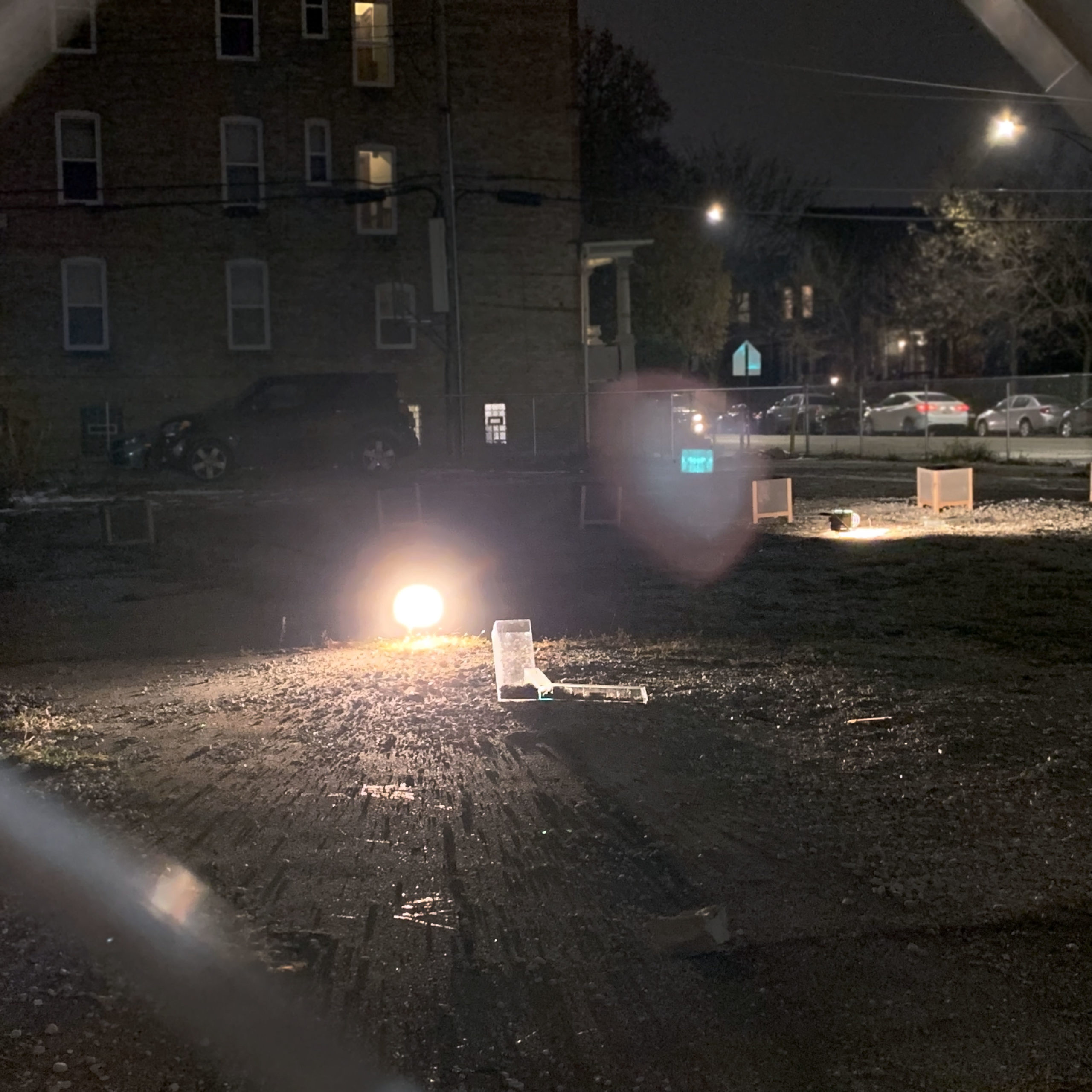
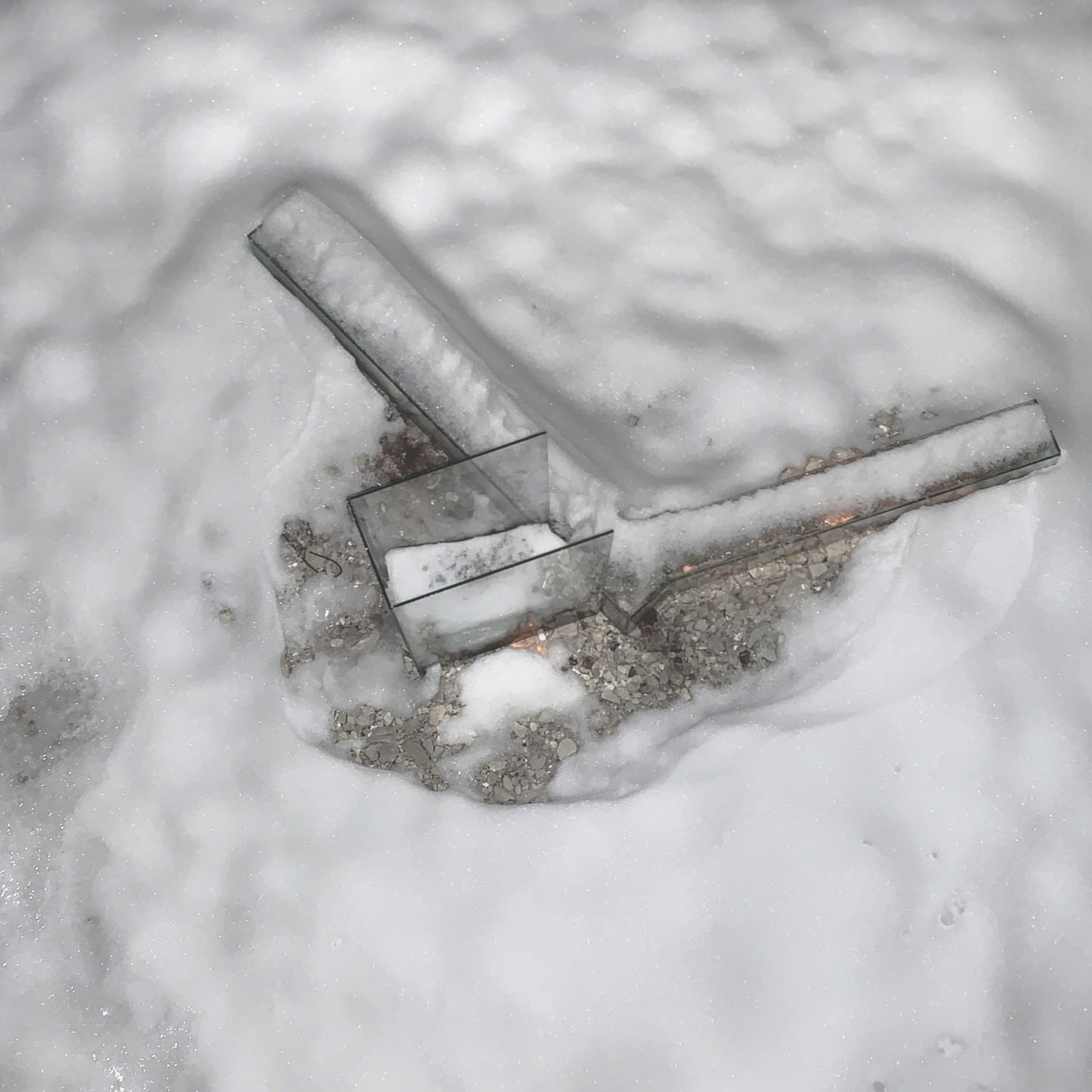
New urbanism posits street corners as sites of physical and emotional strong holds in communities as crucial points of civil life.3 Developers—well aware of what visibility from two streets offers in terms of location premium—have likewise taken note, and corner sites are disproportionately more expensive to rent for commercial activities. This lot on 3551 West Diversey was a residential unit before becoming a gas station, and ultimately became a vacant lot adjacent to an artist run space. In addition to re-drawing the old floor plans as the inaugural artist intervention on the site, I have fabricated on site a set of six sculptural glass objects on the points where these floor plans from different time periods intersect. Viewers are afforded clear sightlines through these sculptures as they augment space and intersect each other.
Of the many ways to determine or define what constitutes a neighborhood or community, especially in areas with rapidly changing demographics and housing prices, one way is to consider shared uses of facilities and resources, an example being the garbage collection regions designated by Chicago Department of Streets and Sanitation (DSS).4 How might hollow glass sculptures on a vacant plot offer, even just temporarily, a new central point of exchange and embodied experience in Logan Square?
I invite members of the public to dispose of used cooking oil in the glass sculptures during determined hours that are situated where the gas station was formerly located on the lot. The flow of liquid and process of casting becomes a participatory process. With the end of the exhibition period, the oil will be emptied and the glass sculptures dismantled on-site. The used cooking oil will be transported by the artist to Loyola University, where it will be processed and turned into a clean burning renewable fuel.5

Rebecca Denise Tanda (b. 1994) is a visual artist and cartographer currently based in Chicago. Prior to moving to Chicago she participated in several mapping and geography projects in Hong Kong and Mainland China. A graduate of the School of the Art Institute of Chicago, Tanda has exhibited regionally and internationally. Tanda’s work considers space, power and mythology through a materially driven sculptural practice. Tanda was an artist in residence at Franconia Sculpture Park in 2018 and will be in residence at the Foundation Fiminco in Paris from 2020-2021.